Oil shale and tar sands remains a speculative industry in the arid lands of the Colorado Plateau. A general lack of water is why the industry will never be viable. Even if alternative chemical washes are used to separate bitumen from sand, for example, it still requires 1.5 to 2 barrels of water to refine a single barrel of synthetic crude. What this extraction will accomplish is physical damage to the Colorado River watershed, which supplies culinary water to nearly 30 million people. It will also create more CO2 in the atmosphere, which is the #1 killer of the Rocky Mountain snowpack, which provides 85% of the Colorado River's total annual water supply. Our watershed needs investors to create a reliable energy supply that will heal the water supply of the Colorado River, not destroy it.
Click here to read this color booklet created by Living Rivers and the Colorado Riverkeeper
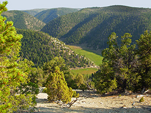
Read this article about strip mining tar sands in Grand County
To SUBMIT A LETTER of concern to Utah Division of Oil, Gas and Mining click here
Article with talking points
____________________________________
INVENTORY OF TAR SAND DEPOSITS IN UTAH
State Land (SITLA)
Federal Lands (BLM)
- NOTE: there are no tar sands in Colorado or Wyoming.
- 2008 - Total identified is 430,686 acres
- 2012 - The proposed preferred alternative identifies 91,045 acres
- RECORD OF DECISION (Issued March 22, 2013)
____________________________________
NEW
AMERICAN SANDS ENERGY (West Tavaputs Plateau near Mt. Bruin)
2014 - Notice of Intent to Commence Large Mining Operations
____________________________________
ADMINISTRATIVE RECORD OF UTAH DIVISION OF OIL, GAS & MINING (UDOGM)
ADMINISTRATIVE RECORD OF PROPOSED STRIP MINING @ PR SPRINGS
US Oil Sands (Utah) Inc., (formally Earth Energy Resources)
ADMINISTRATIVE RECORD OF UTAH DIVISION OF WATER RIGHTS @ PR SPRINGS (State Engineer)
Water Right for US Oil Sands 49-2274 (a33805)
Other water rights (adjacent to proposed mine @ 4.5 gallons per minute)
Additional water well information (state and federal)
ADMINISTRATIVE RECORD UTAH DIVISION OF WATER QUALITY (DWQ) for PR SPRINGS
TRANSCRIPTS OF HEARINGS FOR PR SPRINGS STRIP MINING OPERATION
ADMINISTRATIVE RECORD OF ENVIRONMENTAL PROTECTION ADMINISTRATION (EPA)
Air Quality at Proposed PR Springs Mine
____________________________________
ASPHALT RIDGE MINING OPERATIONS (near Vernal, Utah)
Crown Asphalt Ridge (CAR) Korea Technology Industry of America (Defunct)
MCW Energy Group @ Asphalt Ridge
____________________________________
BUREAU OF LAND MANAGEMENT
Paving Seep Ridge Road in Uintah County
2008 Oil Shale & Tar Sands Programmatic EIS
____________________________________
CORPORATE WEBSITES
____________________________________
DOCUMENTS
____________________________________
ECONOMIC VIABILITY
____________________________________
ENDANGERED AND THREATENED SPECIES
____________________________________
GEOLOGY
Oil Shale and Tar Sands web page. Utah Geologic Survey.
Tar Sands Bibliography (2009). UGS.
USGS publications library
Geologic Bibliography
____________________________________
LEGAL DOCUMENTS
____________________________________
MAPS & GIS
Google Earth
PR Springs
Green River Refinery (proposed) (click here)
SITLA
University of Utah
Other
____________________________________
NEWS
____________________________________
NON-PROFIT ORGANIZATIONS
____________________________________
PHOTOS
Aerial Photos
Satellite Images
____________________________________
TRADE ASSOCIATIONS
____________________________________
UNIVERSITY
____________________________________
USGS
____________________________________
UTAH GOVERNMENT
____________________________________
VIDEO
____________________________________
WILDLIFE
Southest Utah (includes East Tavaputs Plateau)

Discussion:
Talk about this article...